
You can scroll the shelf using ← and → keys
You can scroll the shelf using ← and → keys
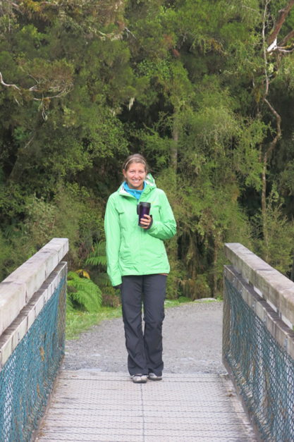
 After a restless night of sleep spent spooning with the most annoying sonsabitches we’ve encountered since some of the street vendors in Saigon sand flies, we rose early, making haste and driving like we stole it to get to the coast. Weaving our way through gold country, this was the most remote of regions we had encountered in New Zealand. The West Coast (or Westland, as it’s sometimes referred to) is inhabited by only the heartiest of souls drawn by the mild climate and the isolated lifestyle the area affords them. Like the wild west of old, this region was full of boomtowns during the gold rush of the 1860s, welcoming with open arms some endless waves of Kiwis looking for their big break. Things have quieted down significantly since then in this area, where only about 1% of New Zealand’s population calls the region that takes up 9% of the country’s area home.
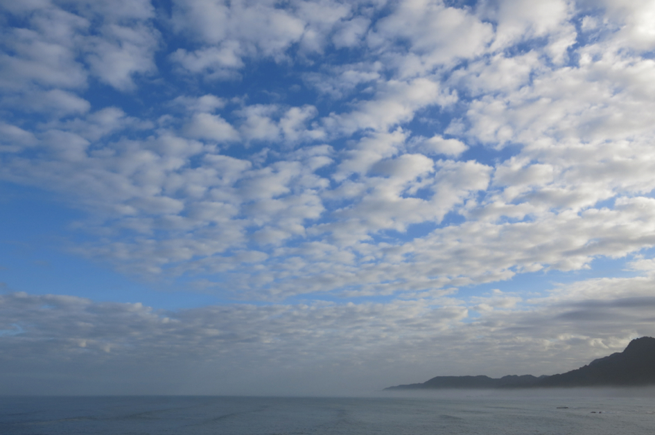
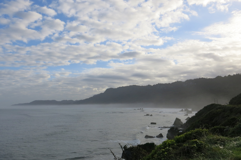
A look out from Knight’s Point on SH6 – New Zealand’s version of Hwy 1 in California.
Now that you’re armed with history and context, let’s get to the good stuff. We covered a lot of ground in a few quick days, so instead of boring you with all the step-by-step details of our journey, Imma give you a sixer of some of the best of the West:
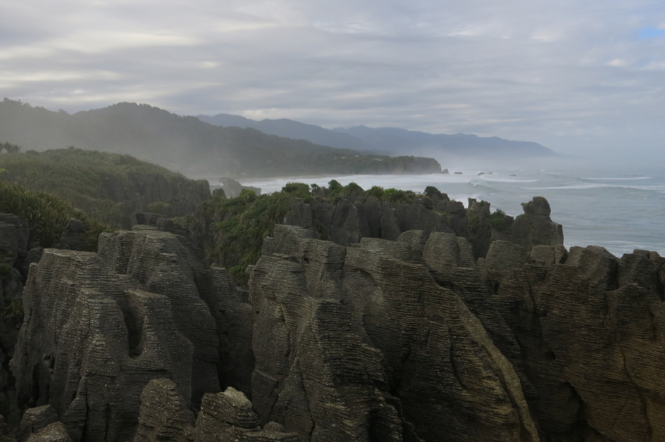
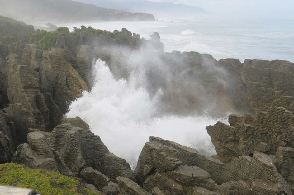
High tide at the Pancake Rocks.
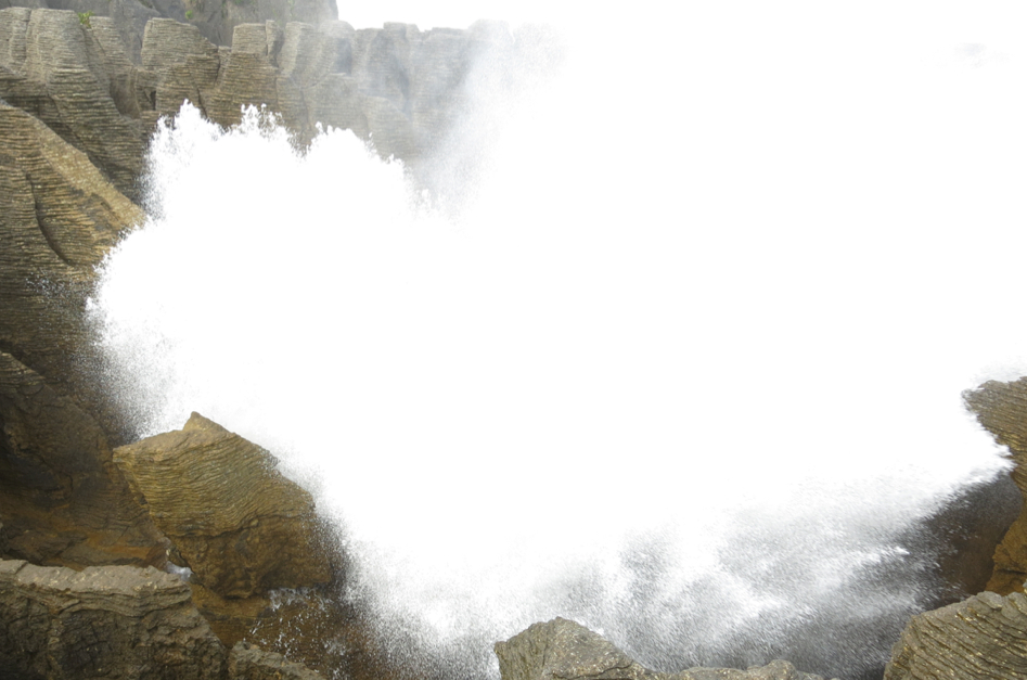
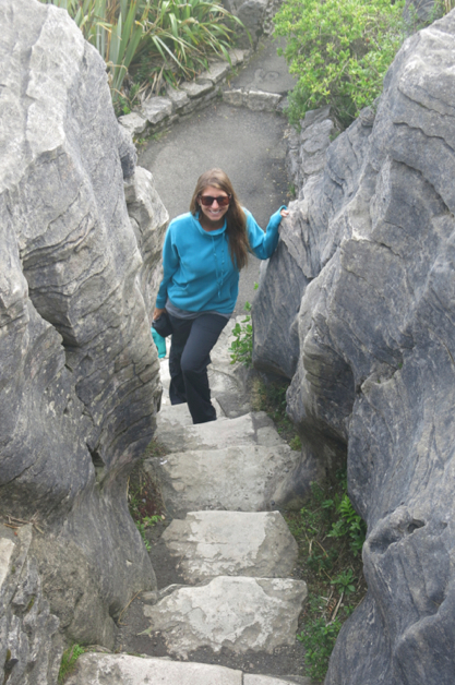
1. Pancake Rocks at Punakaiki – Fittingly, we stopped at that firmly-on-the-beaten-track destination right around breakfast. By happenstance, we beat some of the tour buses and arrived right at high tide. The dramatic sights and booming sounds were humbling (Mama Naytch at work yet again). The rock formation earned its memorable moniker through a long layering-weathering process called “stylobedding.” This caused the limestone to form into what appear to be endless stacks of pancakes. The sea has also eroded a few areas from the base of the rocks, helping form blow holes that, at high tide, put on full display the awesome power of the ocean as waves crash toward shore and erupt through the blowholes like overweight geysers. That’s a long way of saying it was really cool.
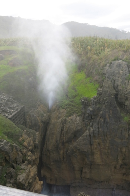
One of the many blowholes.
Ka.
Boom!
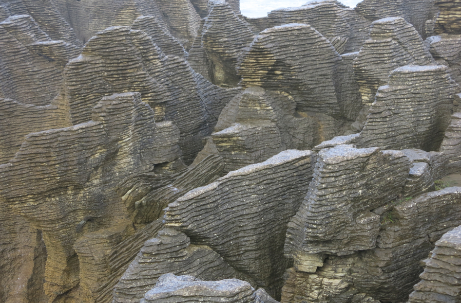
Like pancakes… but way, way harder and more rock-like.
Hey, girl.
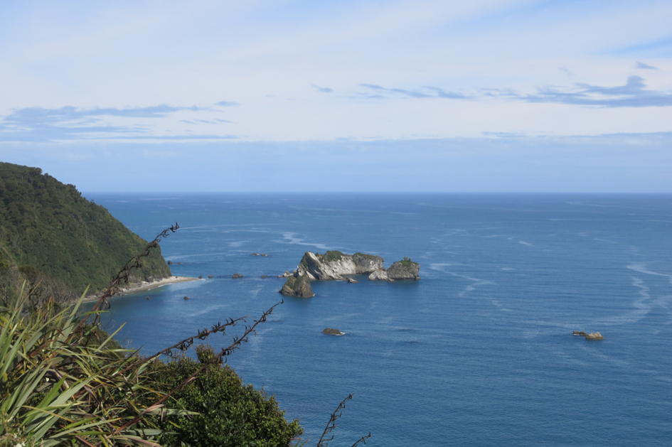
More coastal views just outside Punakaiki.
2. Greytown and Hokitika – Rolling down the coast, smoking tires, sipping on coffee and water (with my mind on a haircut and a haircut on my mind) we arrived in Greytown. The biggest of the West Coast’s cities, this was most memorable for the fact that I got my first trim in 10 months here. After I lost the locks we only had enough time for a quick tasting at Monteith’s Brewery before carrying on to Hokitika. Aside from being a fun word to say, Hokitika also gave us one of our favorite fish-n-chipses to-date.
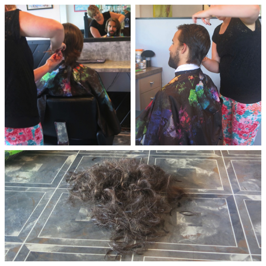
It all happened so fast…
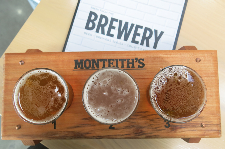
Sampling some Monteith’s.
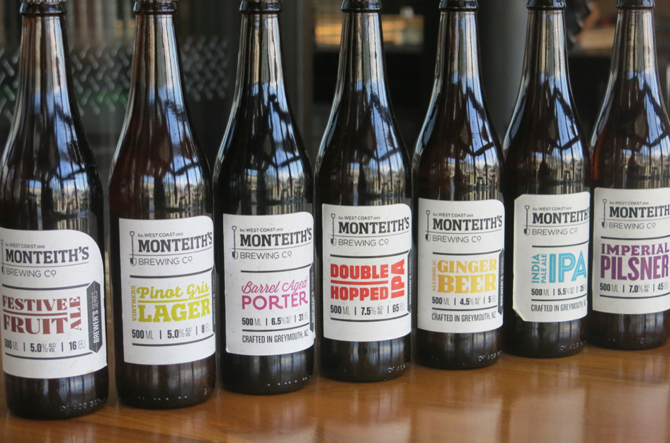
The full line-up.
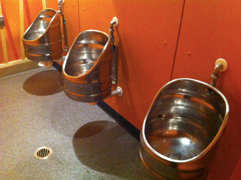
And the keg urinals in the brewery bathroom. Brilliant.
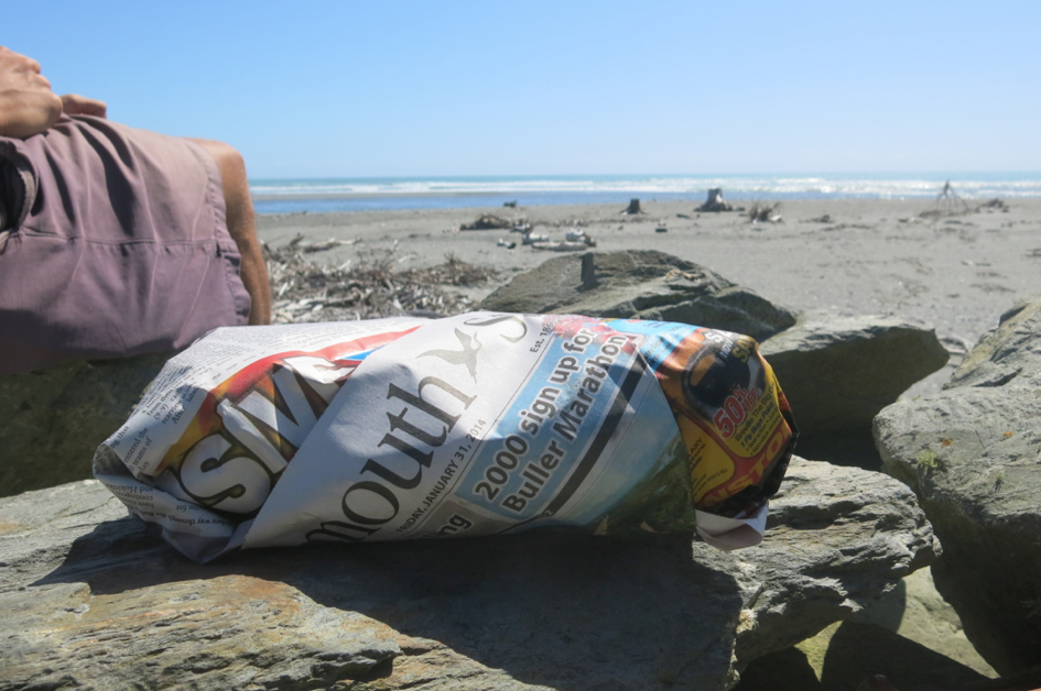
About to tuck into a fish & chips from Dulcie’s on the Quay in Hokitka. The good stuff always comes wrapped in newspaper.
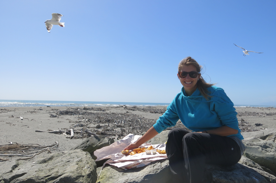
Mine!
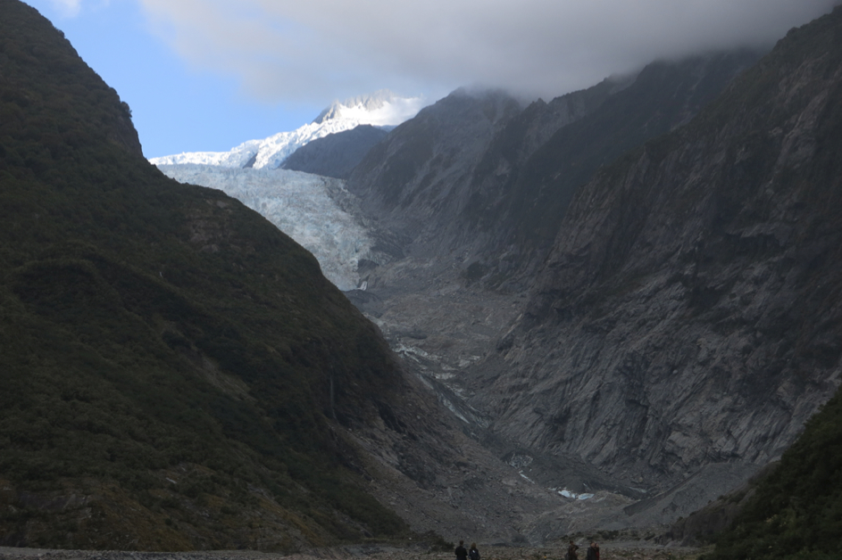
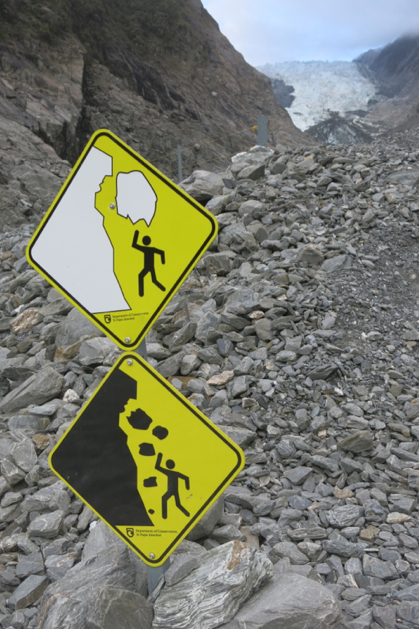
3. Glaciers (or, if you prefer, glay-see-uhhs) – The bulk of the West Coast is bracketed by the Southern Alps to the east and the Tasman Sea to the west, making for some great visual candy in all directions. And soon after the mountains came into view we entered glacier country. Fox and Franz Josef Glaciers are two of the most easily accessible glaciers in the world, both coming into view within a short walk from their respective car parks. We made it to Franz Josef in time to make the 1.5hr walk toward the terminal face of the glacier to catch what we thought would be an up-close view before sundown. When I was in this area in 2007, both glaciers filled the slopes of the southern alps nearly all the way down to the valleys below. Fast forward seven years and the bottom face, or ablution zone (glay-see-uhh terminology, amiright?), of Franz Josef has receded nearly halfway up the mountain, to the point where guided hikes need to be helicoptered onto the glacier since hiking up from the bottom has become too dangerous. Alas, our viewpoint photos would have to suffice.
Going in for a look at Franz Josef.
Well, yeah. Duh.
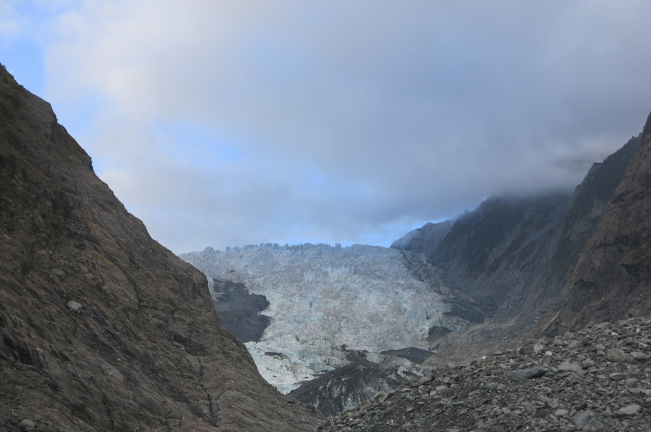
Check out the ablution zone on that guy.
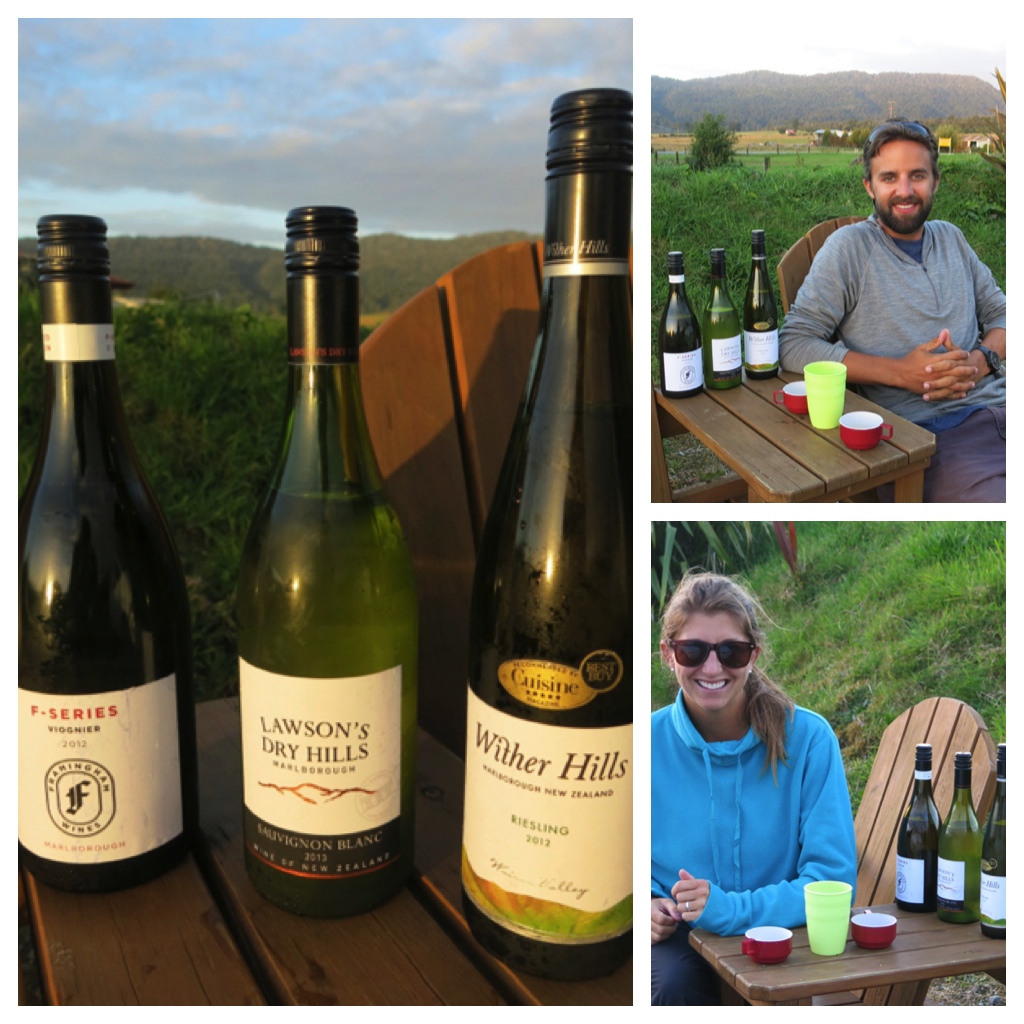
Sampling some of our favorites from the recent stop in Blenheim. Noelle is smiling through internal outrage caused by losing to me in our blind taste test. To be fair, I only guessed one right. But if you ain’t first, you’re last. (EDITOR’S NOTE: I call a rematch! Going second, I’m pretty sure the sediment left in the glass from Dave’s tasting interfered from my palate’s ability to detect the proper tannins. YES! That’s it! I WIN! I WIN!)
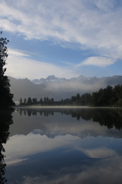
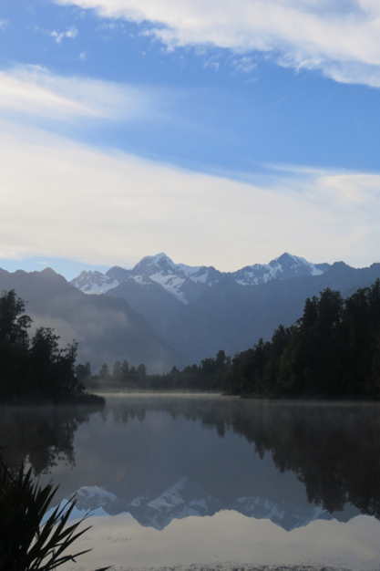
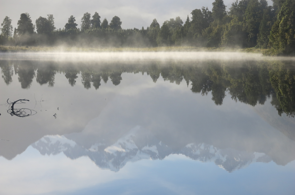
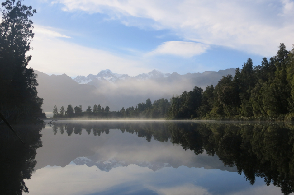
4. Lake Matheson – Having gotten our glacier fix with Franz Josef, we opted for another hike near Fox Glacier that didn’t involve a close-up view of the ice formation. A short drive from our campground, the path to Lake Matheson awaited and was kind enough to play nice and provide the postcard-perfect views we had hoped for. The lake is often referred to as a “mirror lake” because of the water’s smooth-as-glass surface creating a perfect reflection of whatever is off in the distance. The thing that sets Matheson apart from others like it is its “off in the distance” view is of none other than New Zealand’s two highest peaks, Mt. Cook and Mt. Tasman. The views through the forest and out onto the misty morning water throughout the walk are idyllic if you catch it on the type of day we did, but the fact that the two main lookout points are named “Reflection Island” and “View of Views” tells you all you need to know about the main attractions.
Misty morning start to our Lake Matheson walk.
Coffee in hand, ready to roll.
Oooooohhhhh.
Aaaaaahhhhhhh.
This is only a sampling. I’m pretty sure I took more photos here than we did at the Taj Mahal.
(EDITOR’S NOTE: My editing job was particularly edifying this go round as I reduced the number of photos he included by almost 3/4. You’re welcome, readers)
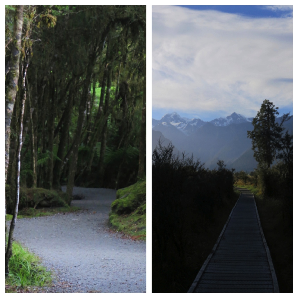
A couple shots from the path in and out of the lake.
Nature.
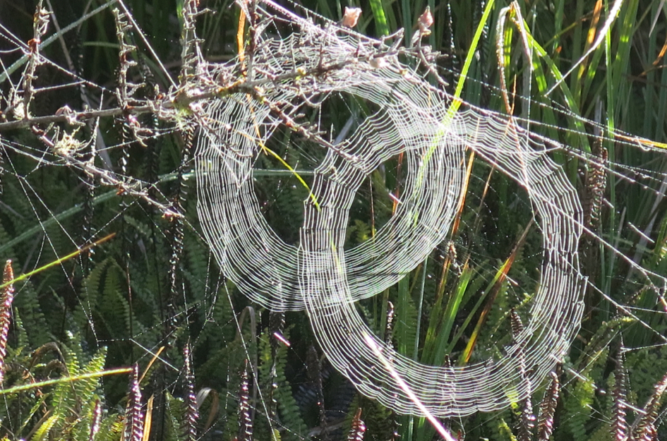
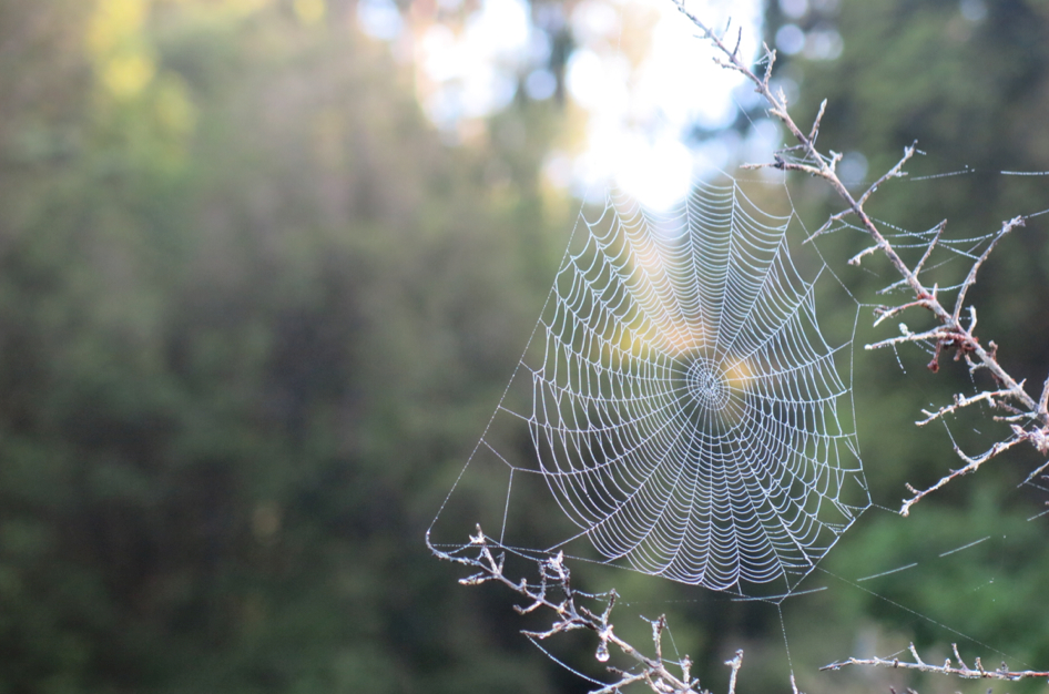
Crazy amounts of spider webs of all different sizes and designs along the path.
5. Wanaka views and beers – While this isn’t technically part of the West Coast, there’s a very good reason for it to be included in this post. We just kinda decided to add it here (good enough a reason as any, no?). In any case, Wanaka provided an easy stopover en route to our next destination, Queenstown. But the sometimes-overlooked city has plenty of reasons to warrant at least an overnight in the area. In many ways it plays the role of the quieter, shy younger sibling to crowded Queenstown. But it’s following suit of older brother with a comparable number of tour companies and outdoor adventure opportunities right in its own backyard. We stayed for one night only, before making haste (so much haste in these parts), for Queenstown. But before getting back on the road we stopped in at Wanaka Beerworks, a much talked about craft brewery that still is operating on a pretty small scale, but can hold its own against some of the best we had just tasted in Nelson and Wellington. The Apline Miere Dry Golden Ale in particular was a favorite of ours, with surprisingly satisfying notes of orange and honey that typically wouldn’t be our speed.
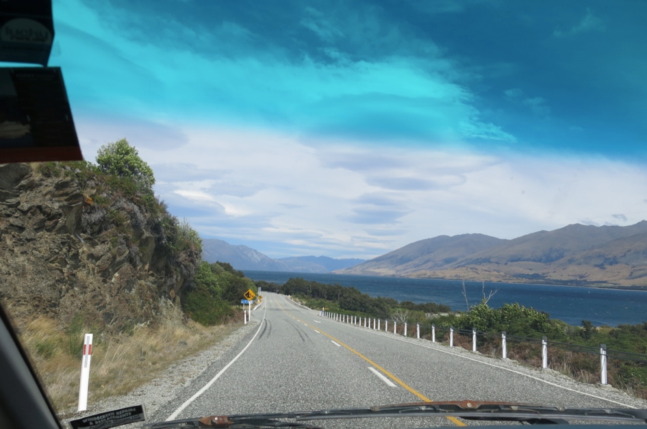
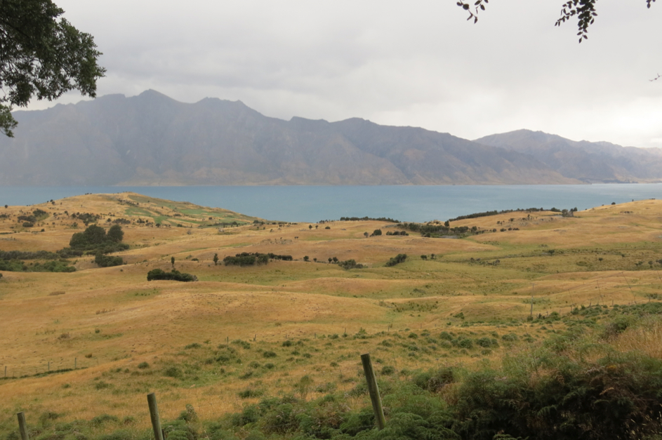
Coming in on the approach to Lake Wanaka. The views just. won’t. stop.
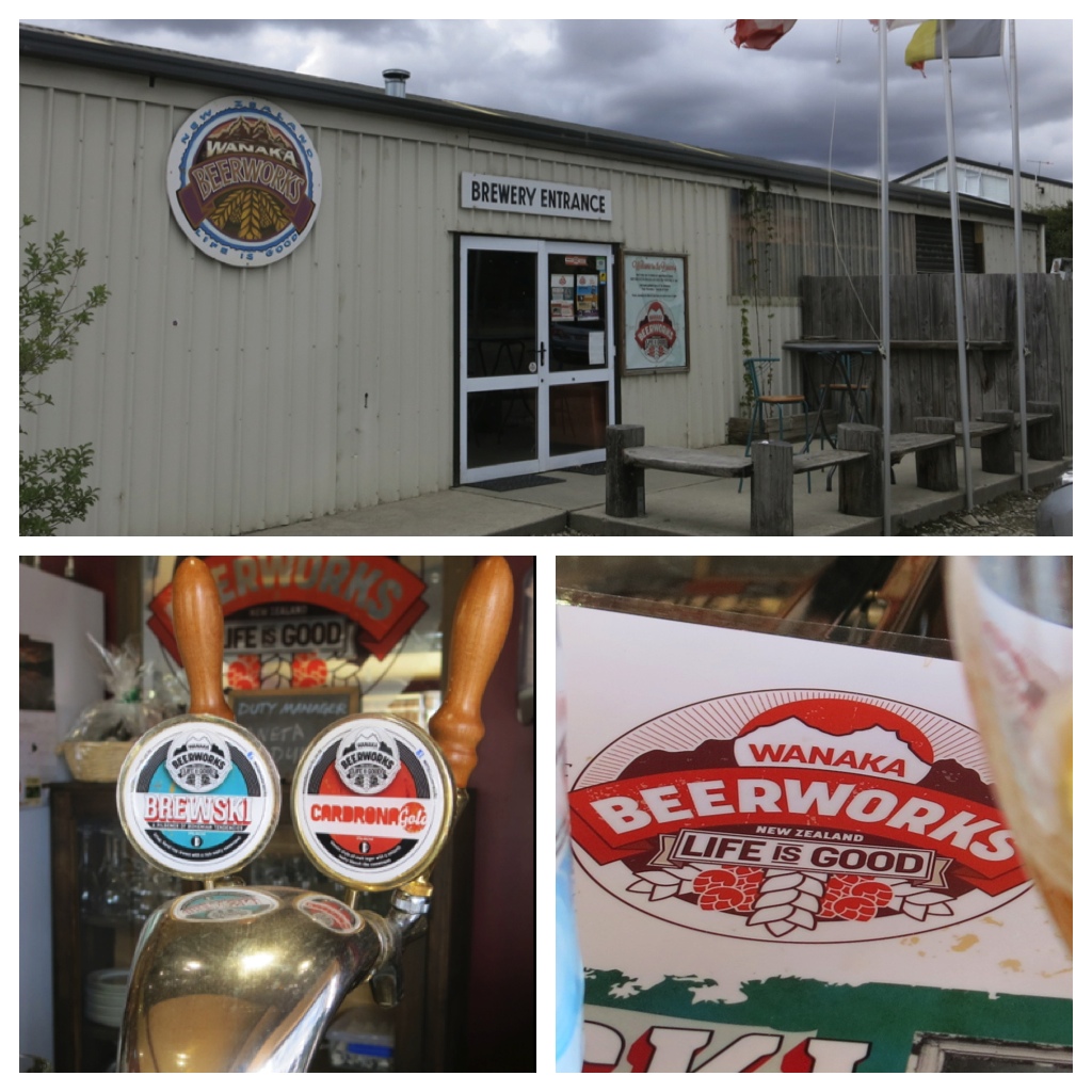
At Wanaka Beerworks. What the brewery lacks in looks it made up for in taste.
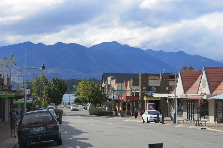
A slow afternoon in downtown Wanaka.
Beers and billiards. A good way to pass said slow afternoon.
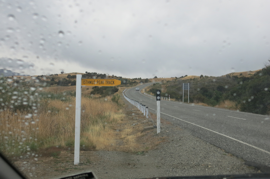
Our hopes of climbing to Isthmus peak were dashed with a thunderstorm.
Still saw some decent views during our short time on the trail pre-storm. Because New Zealand.
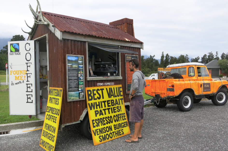
Taking a break just before Haast Pass to order up a whitebait patty from a mobile cafe.
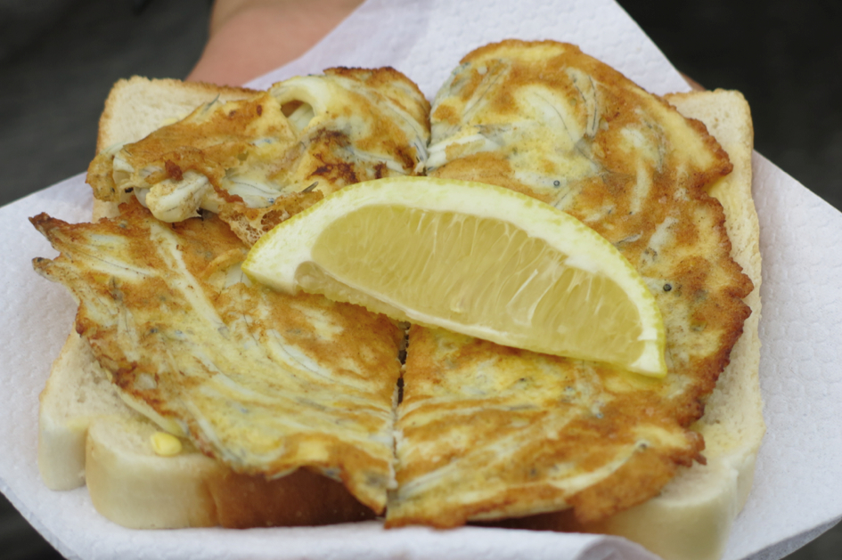
The finished product. This NZ staple is basically a fried egg patty cooked with Whitebait fish on buttered bread, finished off with a squeeze of lemon.
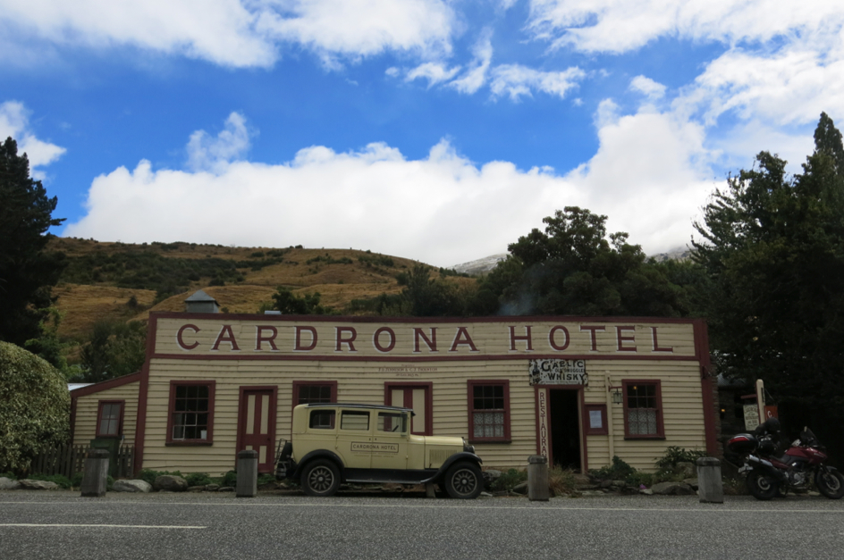
6. Cardrona Hotel – This gem tied a quaint and cozy bow on this leg of the south island for us. Completely by chance, the Wanaka Beerworks bartender gave us one of the best recommendations we received in the entire month in New Zealand. On her advice, we zigzagged our way through 70kms of mountain views, following the Crown Range Road en route to Queenstown. Aside from the tussock grass fields, rolling hills and snowcapped mountains along the ride, it also sports a hotel bar and restaurant that has barely changed – for good reason – since it opened its doors 150 years ago. The roaring fire in the dining room at the Cardrona Hotel provided a welcome respite from the cold wind and rain so we tucked into a bowl of seafood chowder and a beer on a comfy fireside couch.
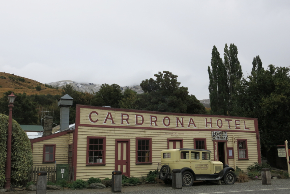
Picturesque Cardrona Hotel, just as it was 150 years ago.
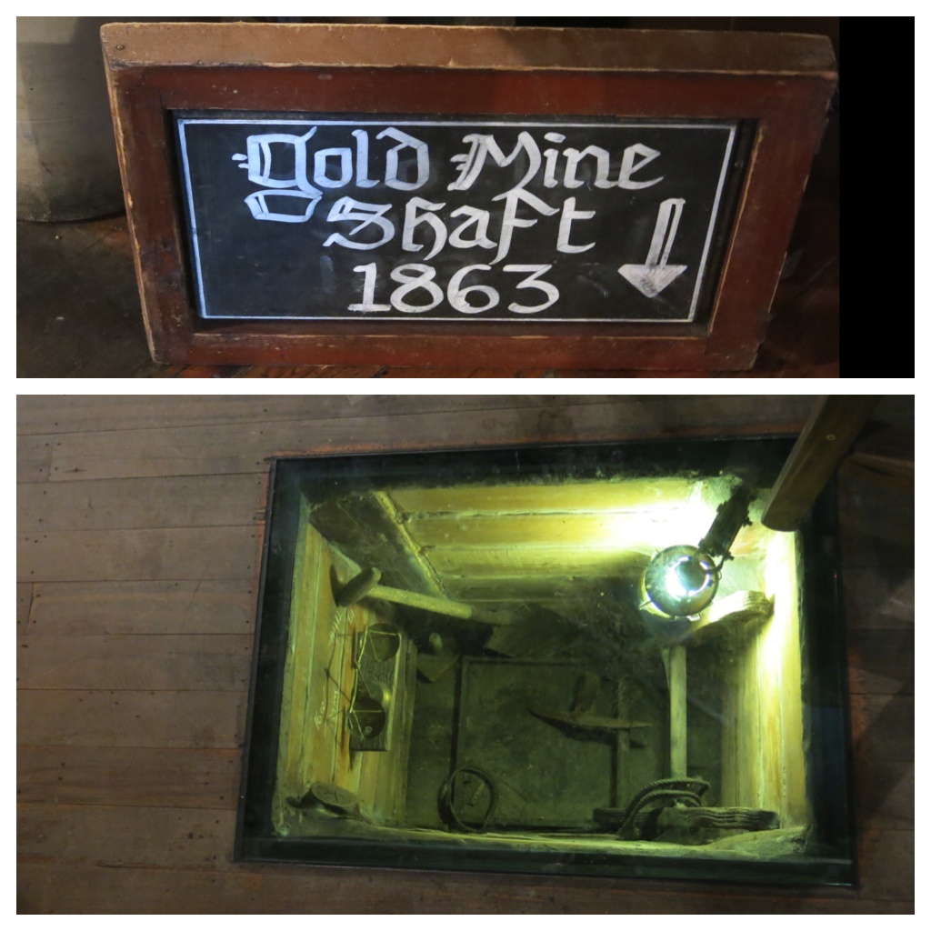
Built over a gold mine. Literally.
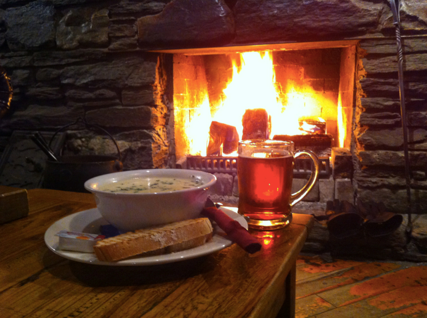
Chowder and beer by the fire. Ma-nom-a-nom.
Who knew that a bowl of seafood chowder and a cold beer was all it would take to bring back the blue skies?
Recharged and ready to go, we walked back to the van to find that the sun had come out and lit up the peaks atop the hills in every direction. And with that, we were off to Queenstown.